

7/30/2020 3:49:29 PM
By Moriah Boggess
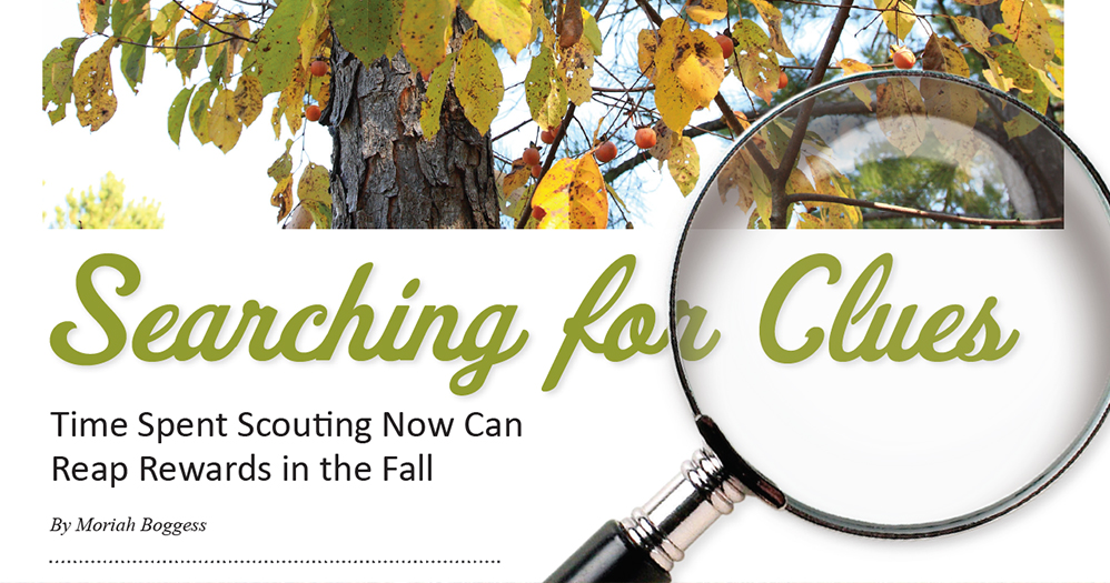
While summer can be a slow time for hunting, what you do with your free time now can set you up for success this fall. Summer scouting increases your familiarity with the woods you will hunt in fall, giving you an advantage when hunting season arrives and reducing time spent hunting unproductive areas. Before you think about a summer-scouting strategy, you should determine what you hope to gain from it. Observations in the woods during summer are clues to what happened in the past and might (or might not) happen in the future. Sometimes deer movement patterns change, a ridge with oaks that were dropping acorns last year might not produce this year, and a river bottom that experienced substantial rut activity the previous fall could be flooded this year.
Scouting activities fall into three categories: map scouting, summer scouting, and in-season scouting. Though this article addresses summer-scouting tips, these simply are building blocks to inform in-season scouting and hunting decisions.
Map Scouting
Map scouting can be completed at any time of year but should be done before you spend any time walking a new property. To get started, identify the boundaries of parcels you are going to scout (use any online mapping application or county GIS website that shows parcel boundaries).
On public ground, the next step should be purposeful, in that you should identify all areas that are difficult to reach because of access obstacles, such as thickets or water crossings that are at least a half-mile from a parking area. On private parcels, the difficulty of access is less of a concern. However, regardless of property type, access routes are essential to hunting success and should be considered before moving forward with your scouting mission. You should find whether your potential access route will put you up-wind of deer traveling past your stand, if possible bedding or feeding sites will be disturbed on your approach, or if deer moving by your stand will cross your access path and be alerted. Alternative access points or methods could be necessary if these access issues are present. Identifying these potential issues will help you identify promising broad areas on your map and more importantly eliminate the poor hunting areas before stepping foot on a property.
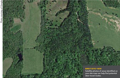
Next, search satellite imagery of the broad areas identified on your map and look for land cover features that indicate potential travel routes. Examining imagery of the parcels can give you a feel for what the most common cover types are, but pay attention to those that are least common. For instance, if you are looking at a property that is mostly covered in planted pines, key in on any break in the pine forest, such as hardwood drainages, old-fields, or sloughs. Clearcuts, openings created by flooding, oak patches, and overgrown fields are all excellent cover types that are often limited on Mississippi parcels and can be dynamite for deer hunting.
You also should take a broad look at cover types on the property and try to identify edges where these intersect. Deer often travel parallel to the cover edges. When three or more land-cover features intersect, drop a pin on your map. Generally, the more edges intersecting in a location the better, as this provides more potential travel routes that lead to the spot. Some examples of land cover edges common in Mississippi are the edges of pine plantations, hardwoods drainages, overgrown fields, rivercane thickets, or briar patches.
Pinch points are also easily identified on a map. Pinch points are created by abnormally shaped land features like forest openings, water bodies, and windblown trees. These features discourage deer movement through a location because of obstacles or exposure to danger, so deer choose to go around them, and this concentrates their movements. Classic pinch point examples are field corners where deer walk around the corner just inside the forest edge to avoid walking through the opening in daylight. Another example commonly occurring in bottomland forests is a sharp river bend or oxbow lake that bends deer movement around it. Mark all the pinch points, intersecting cover types, and any other patches of cover that look interesting on your map. These will be the points to explore during an in-person scouting trip.
Summer Scouting
In-person ground scouting allows you to test whether signs of deer on the ground confirms your suspicions from map scouting. Doing this scouting in summer accomplishes two things: You save time in fall by eliminating useless areas before the opening of deer season and any deer you spook during summer will soon dismiss your intrusion and return to their regular habits.
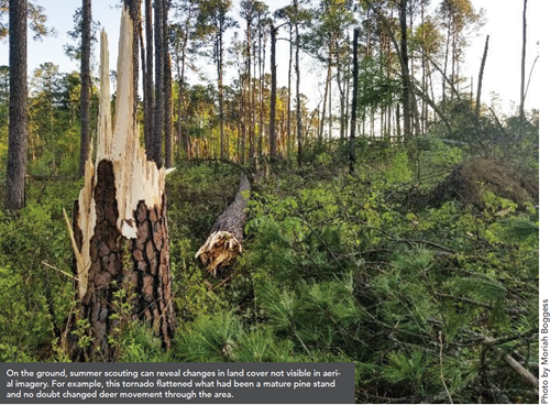
While doing your summer in-person scouting, remember the ultimate question you are asking is whether deer use the area in fall, not summer. Seeing fresh tracks, scat, and deer while walking a new area is encouraging but these things could misrepresent the potential of a spot in fall. Often, deer use different core areas in summer than fall because food availability, cover quality, and human activity change with the season and affect deer use. However, high concentrations of deer use in summer can indicate a high deer density in the general area, so you should note these areas while tempering your expectations.
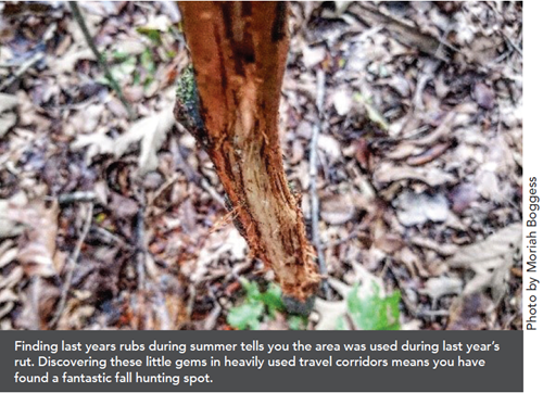
Ultimately, signs of past deer use are the main indicators to evaluate during summer scouting. These signs traditionally include trails, beds, rubs, and scrapes. The most important of these for summer scouting are trails and beds because they seem to be the least variable from year to year. Generally, influencing deer travel remains constant, and bed sites are usually selected because of variables like wind direction, visibility, and cover that change little between years. Rubs and scrapes sweeten the look of a spot, but you should rarely return in fall to hunt a spot if these are the only clues obvious in summer.
As you evaluate a new hunting spot, try to cross-reference the sign you are seeing with cover types and edges to speculate why deer are using an area. This will give you clues as to what time of the day deer are frequenting a location.
For instance, if you find lots of rubs and scrapes along a large agriculture field but rarely see deer in the field, you can reasonably conclude that this activity is occurring at night. Likewise, evidence of heavy rut along the edge of dense cover near bedding will not tell you that deer are using the spot in daylight, but it is much more likely in this case.
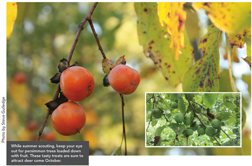
One last thing to note while scouting a property is food sources, particularly oaks and persimmons. Always look for persimmons along the edges of water and check them for fruit annually (and return for an October hunt if they are producing fruit). You also should inspect oaks annually for acorns and note which ones are producing well.
Piece it all together
Map and in-person summer scouting gives you familiarity with the property and tells you if deer have used an area in the past. While I rarely select which tree I want to hunt while summer scouting, my work now tells me where to focus my efforts in fall. Remember, even with the best scouting, deer patterns fluctuate annually, so use summer scouting to narrow down the locations of a property. In fall, combine your summer intel with real-time observations as fall movement patterns emerge. Time spent now will make your fall much more productive when combined with fall scouting.
Moriah Boggess is a graduate student at the Mississippi State University Deer Lab.

