Importance of Aerial Surveys
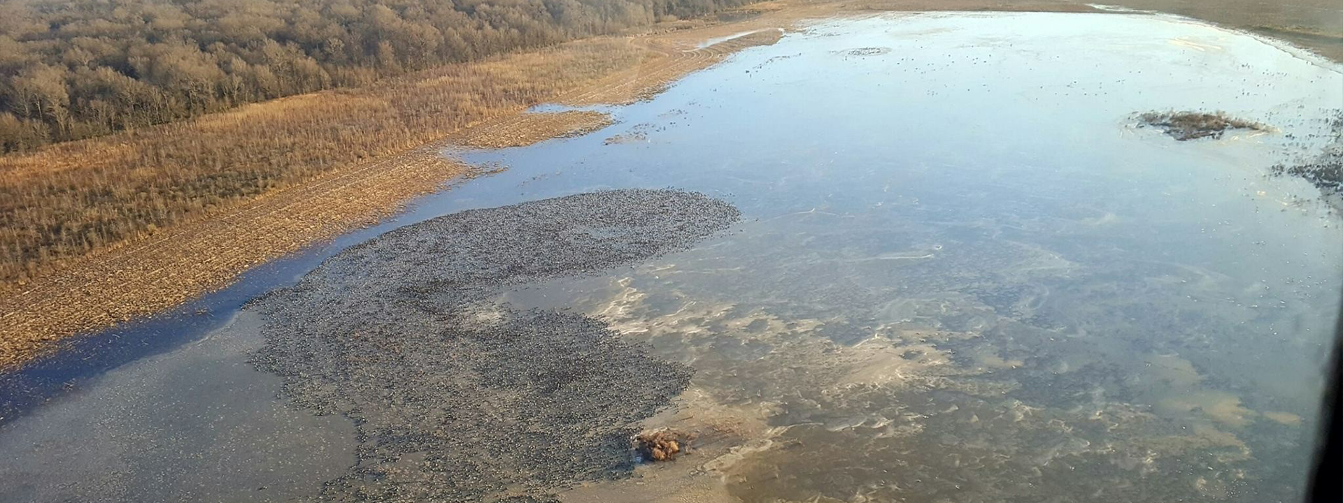
Waterfowl are among the most studied and pursued wildlife. One of the most critical tools used by the Mississippi Department of Wildlife, Fisheries, and Parks (MDWFP) is the aerial waterfowl survey. Starting in mid-November, biologists monitor the influx of ducks and geese into Mississippi, assessing their numbers and distribution as they establish their winter territories.
Counting these birds is a challenging task since they are highly mobile, often flying several miles daily in search of suitable habitats. Rather than employing simplistic methods, MDWFP utilizes a more scientific approach through aerial transect surveys. These surveys, developed in partnership with researchers from Mississippi State University and the U.S. Geological Survey, involve flying predetermined flight paths to count birds within specific strips, allowing for reliable estimates across the Delta.
While these surveys do not yield exact counts, they provide valuable insights into general trends in waterfowl populations and habitat usage, collected through randomized transects ensuring unbiased sampling.